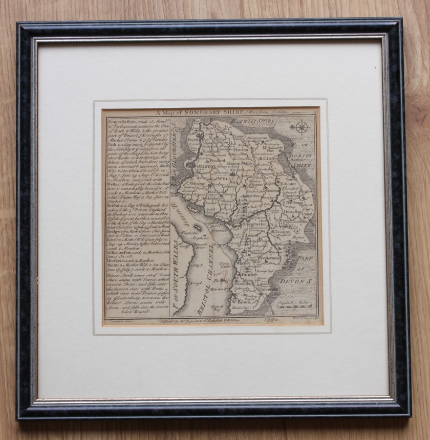
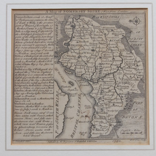
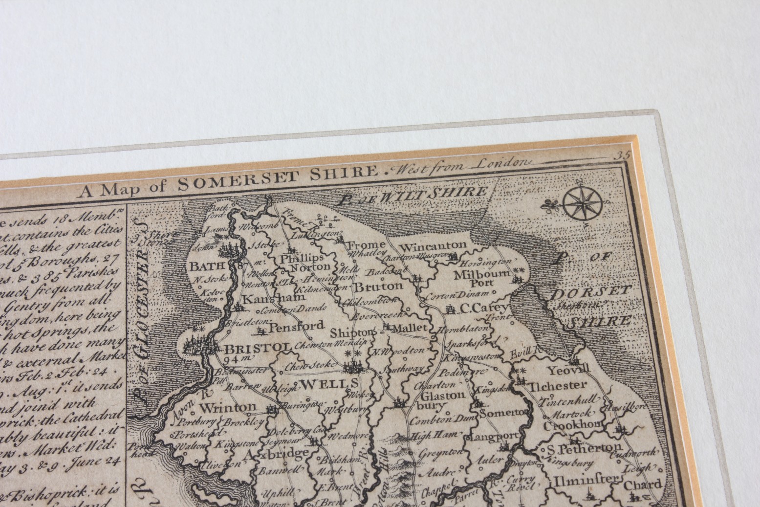
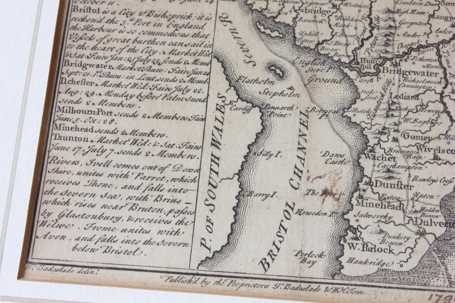
Antique Map of Somersetshire by T. Badeslade / W. H. Toms c1742. Old Somerset
SOLD
Missed this item? Please contact us to add similar to your wanted list.
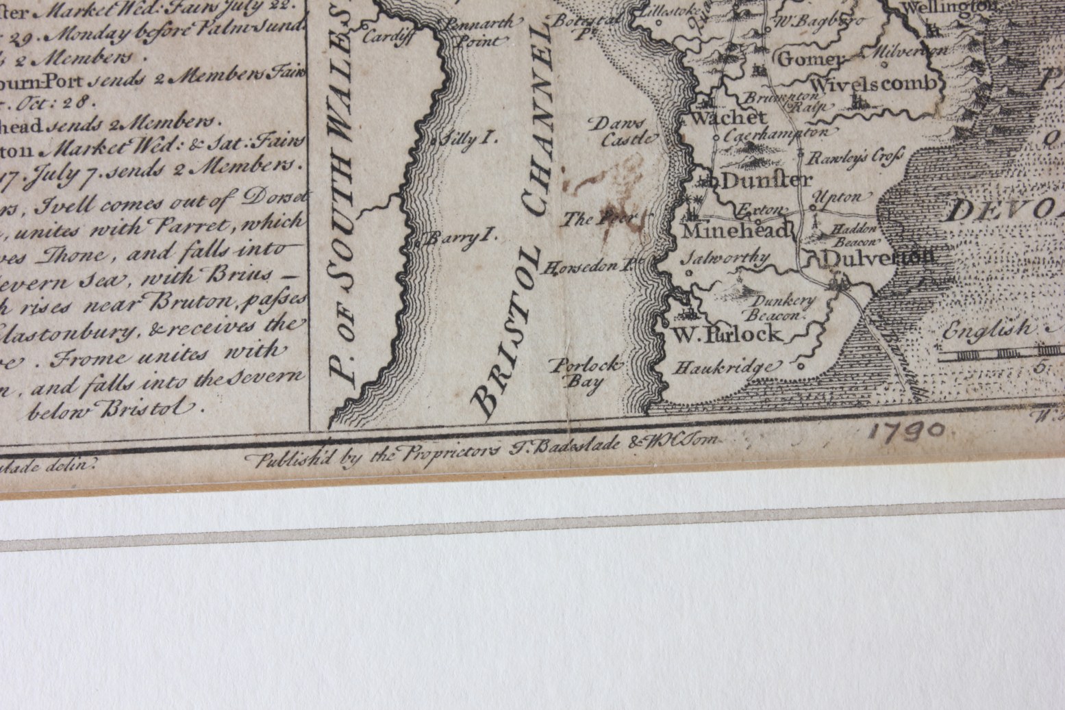
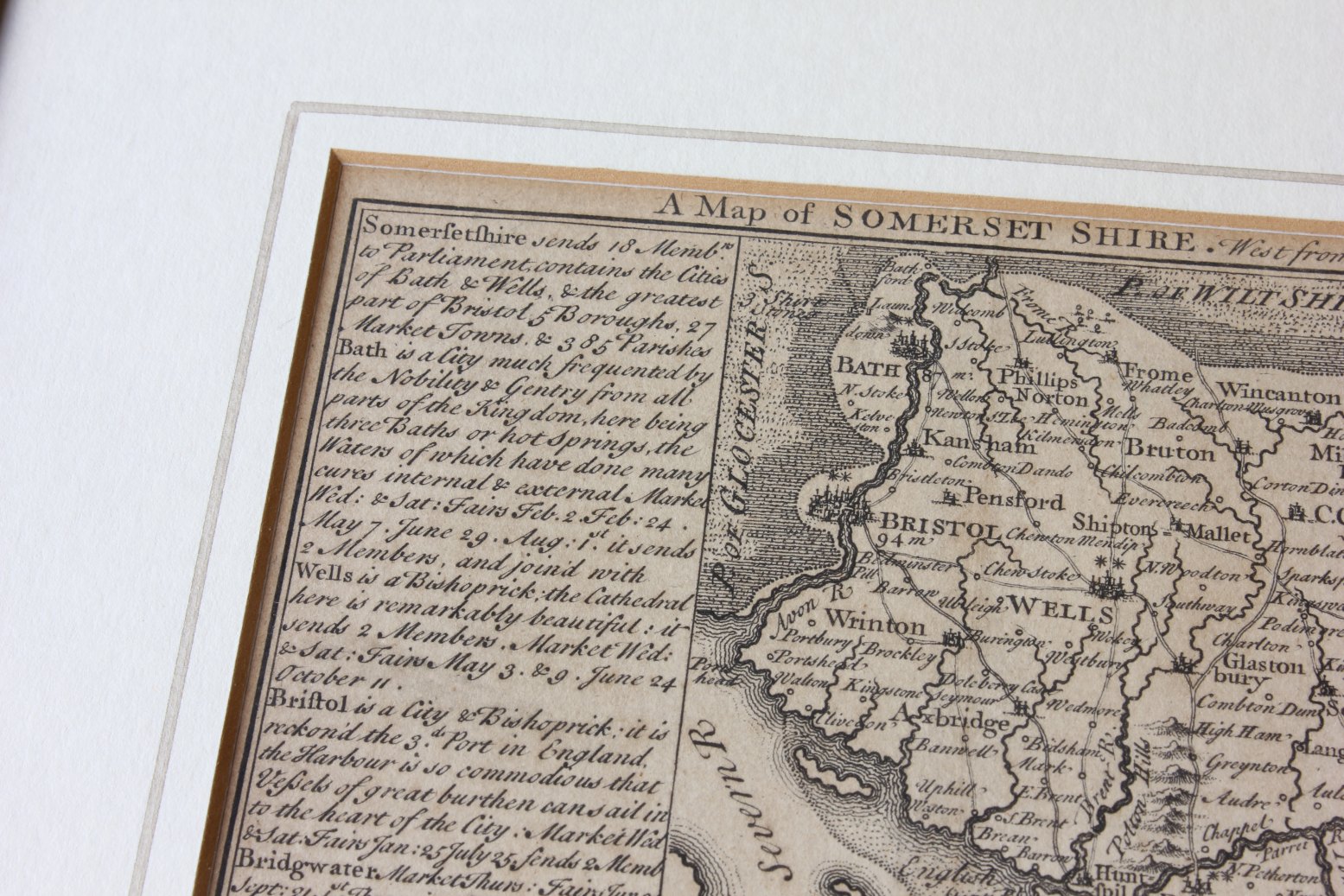
An interesting and scarce antique map of Somersetshire dates from c1790.
This genuine antique copper plate printed map was Published and Engraved by T. Badeslade / W. H. Toms. Includes, Bristol, Wells, Bath, Bridgewater, Glastonbury, Bristol Channel and others.
The map has some slight discolouration/staining and foxing. The date 1790 is written in pencil at the bottom of the page but the map was actually printed c 1742. Please see pictures.
Framed, glazed and ready to hang.
Frame size: 29 cm x 29 cm
Printed area: 15 cm x 15 cm
Free UK Delivery
Allow 1 - 2 working days for delivery. Express delivery can be arranged.
Can be shipped worldwide. Please contact us for a quote.